홍보물
로빈슨 세계지도 (2016)
Robinson World Map (2016)
한국어
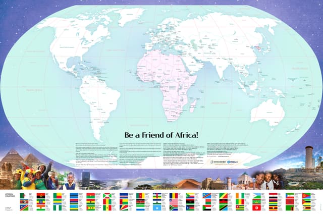
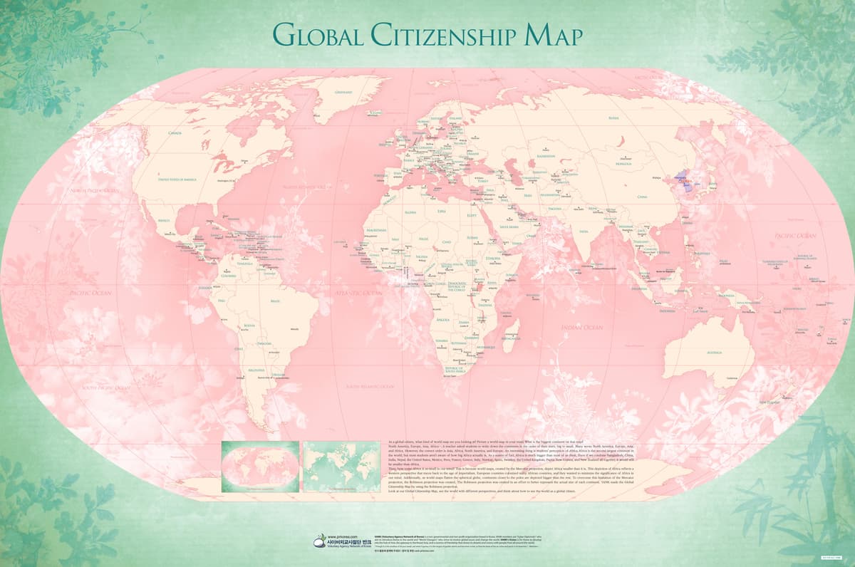
로빈슨 세계지도(글로벌 시민 지도)는 세계 대륙의 실제 크기에 대한 인식을 바로잡는 홍보물이다. 흔히 아프리카를 실제보다 작게 인식하는 것처럼, 익숙한 세계지도가 만들어낸 왜곡된 인식을 짚어보며 진정한 세계시민의 시각을 갖도록 제안한다.
EnglishThe Robinson World Map (Global Citizen Map) is a promotional material that corrects our perception of the true size of the world's continents. People often think Africa is smaller than it really is. This map points out these distortions created by the world maps we're used to, and suggests a way to see the world through a true global citizen's eyes.
자료 원고 · English
Global Citizenship Map
As a global citizen, what kind of world map are you looking at? Picture a world map in your mind. What is the biggest continent on that map?
North America, Europe, Asia, Africa….
A teacher asked students to write down the continents in the order of their sizes, big to small. Many wrote North America, Europe, Asia, and Africa. However, the correct order is Asia, Africa, North America, and Europe. An interesting thing is students’ perception of Africa. Africa is the second largest continent in the world, but most students aren’t aware of how big Africa actually is. As a matter of fact, Africa is much bigger than most of us think. Even if we combine Bangladesh, China, India, Nepal, the United States, Mexico, Peru, France, Greece, Italy, Norway, Spain, Sweden, the United Kingdom, Papua New Guinea, and New Zealand all together, it would still be smaller than Africa.
Then, how come Africa is so small in our mind? This is because world maps, created by the Mercator projection, depict Africa smaller than it is. This depiction of Africa reflects a western perspective that traces back to the age of imperialism. European countries colonized many African countries, and they wanted to minimize the significance of Africa in our mind. Additionally, as world maps flatten the spherical globe, continents closer to the poles are depicted bigger than the rest. To overcome this limitation of the Mercator projection, the Robinson projection was created. The Robinson projection was created in an effort to better represent the actual size of each continent.
VANK(Voluntary Agency Network of Korea) made the Global Citizenship Map by using the Robinson projection. Look at our Global Citizenship Map, see the world with different perspectives, and think about how to see the world as a global citizen.
더 보기 ▾