홍보물
금수강산 한국지도 (2016)
Geumsugangsan: Map of Korea's Beautiful Mountains (2016)
한국어
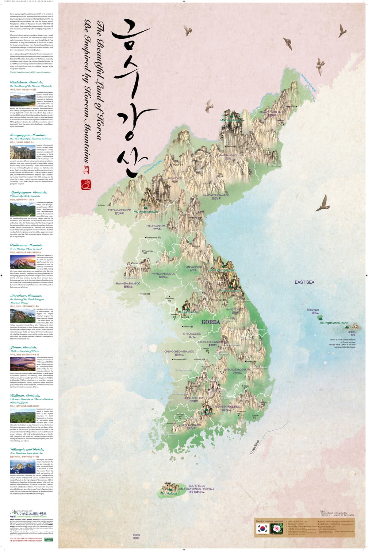
금수강산 한국지도는 국토의 70%가 산으로 이루어진 한국의 아름다운 자연을 소개하는 홍보물이다. 조선시대 학자들이 명산을 유람하며 남긴 기록에서 유래한 '금수강산'이라는 표현처럼, 오늘날에도 등산이 한국인이 가장 즐기는 여가활동임을 함께 소개한다.
EnglishThis promotional material introduces Geumsugangsan, a map showing Korea's beautiful nature, 70% of which is covered by mountains. The word "Geumsugangsan" (meaning "rivers and mountains embroidered on silk") comes from writings left by Joseon-era scholars who traveled to famous mountains. The map also shows that hiking remains the most popular leisure activity among Koreans today.
자료 원고 · English
금수강산 The beautiful land of Korea
Be Inspired by Korean Mountains
Korea is a country of mountains. About 70% of its territory is covered by mountains. Koreans often describe their land as Geumsugangsan, meaning mountains and streams that are as beautiful as embroidered silk. How did it come about? Many Korean scholars of the Joseon Dynasty (1392-1910) left notes about their trips to famous mountains. Koreans still love mountains, and hiking is the most popular pastime in Korea.
Wherever in Korea, we see mountains. Koreans have a broad definition of a mountain, and small hills and ridges are also called mountains. Koreans even used to call islands “sea mountains,” as they perceived them as mountains in water. For Koreans, mountains are more than just beautiful scenery. They were backdrops for important historical events, and they now represent our home and culture.
Let us take you through the beautiful Korean mountains. Explore the highlights of marvelous Korean mountains from Baekdusan Mountain, the backbone of the Korean peninsula, to Hallasan Mountain on the southern island of Jejudo. For our 5000 years of history, Korean mountains were the backdrops for historical, economic, and political changes. So, be ready to be inspired!
Baekdusan Mountain, the Backbone of the Korean Peninsula
Located in Ryanggangdo Province in North Korea, Baekdusan is the highest mountain on the Korean peninsula, with a peak of 2,750 meters above sea level. At its top is Cheonji, a crater lake that was created by rainwater after volcanic eruptions. Cheonji is a large natural lake that spans 9,165㎢ with an average depth of 213 meters. It is surrounded by sharp peaks exceeding 2,500 meters. Historically, Baekdusan has been considered the origin of all the mountain ranges of Korea and revered as a sacred mountain. Baekdusan represents the Korean nation. Although Korea is divided, the South Korean national anthem begins with “Until the waters of the East Sea dry up and Baekdusan is worn away.”
Geumgangsan Mountain, the Most Beautiful Mountain in Korea
Located in Gangwondo Province in North Korea, Geumgangsan is a widely acclaimed mountain with an elevation of 1,638 meters. Due to different kinds of scenery in each season, it was given different nicknames. Its spring name, Geumgangsan, is the most commonly used. Its breathtaking scenery was so widely known that many Chinese and Japanese also dreamed of visiting. Many Korean scholars and students wrote about their trips to Geumgangsan, and top painters drew its scenery. Isabella Bird Bishop, a traveler, a geographer, and the first female member of the British Royal Geographical Society, visited this mountain in the 19th century, and she noted that its beauty exceeds any other mountain in the world. Created by 12,000 peaks, the picturesque scenery of Geumgangsan is our pride.
Myohyang Mountain, Historically Rich Mountain
Located across Pyeonganbukdo and Pyeongannamdo Provinces in North Korea, Myohyangsan stands 1,909 meters above sea level. It was given its name, Myohyang, meaning mysterious fragrance, due to many fragrant trees on the mountain. It is not only scenic, but also rich with many historical and cultural relics. It is the background of the Dangun Legend, Korea’s national birth myth. In addition, it was a base for Korean monks’ patriotic movements in a national crisis. Hyujeong and Yujeong were famous Buddhist monks who led a righteous army to resist the Japanese invasion during the Imjin War. Their records are kept at Bohyeonsa Temple on Myohyangsan.
Bukhansan Mountain, Green Resting Place in the South Korean Capital of Seoul
Bukhansan is located in the South Korean capital of Seoul and Gyeonggido Province. Due to its convenient location, it is visited by 8.65 million a year (as of 2009), making it the most visited national park per square foot in the Guinness Book of World Records. It is a green urban resting place that is created by large granite peaks, including its highest peak, Baekundae (837m), and clear streams flowing down between them. Bukhansan was a key factor that contributed to Seoul becoming the capital of the Joseon Dynasty. As a famous mountain in Seoul, Bukhansan is home to many historical and cultural relics, such as Bukhansanseong Fortress.
Seoraksan Mountain, the Center of the Baekdudaegan Mountain Range
Seoraksan is in the center of Baekdudaegan, the biggest and longest mountain range on the Korean peninsula. It stands 1,708 meters above sea level, making it the third highest mountain in South Korea after Hallasan and Jirisan mountains. It was given its name, Seorak, meaning a big snowy mountain, because snow begins to fall around Chuseok, a Korean national holiday in the fall and stays until the summer. Seoraksan has colorful and exquisite scenery with impressive granite peaks, deep valleys, and amazing waterfalls. Its beautiful scenery attracts 3.62 million visitors each year.
Jirisan Mountain, Mother Mountain of Korea
Jirisan became the first national park in Korea in 1967. It spans 483.022㎢ across the three provinces of Gyengsangnamdo, Jeollanamdo, and Jeollabukdo, making it the largest mountain national park in Korea. Around 20 peaks above 1,500 meters spread out like a folding screen with the three highest peaks, Cheonwangbong (1,915m), Banyabong (1,732m), and Nogodan (1,507 m), as focal points. Its long ridges and deep valleys create beautiful scenery. It provides ample water that gives life to diverse animals and plants. For this reason, Koreans call Jirisan the mother mountain of Korea.
Hallasan Mountain, Volcanic Mountain on Korea’s Southern Island of Jejudo
Located on the southern island of Jejudo, Hallasan is the highest mountain in South Korea, with an elevation of 1,950 meters above sea level. With a crater lake called Baekrokdam on top, Hallasan is surrounded by over 360 parasitic volcanoes called Oreum in the Jeju dialect. When you hike up the mountain, you have a panoramic view of the unique volcanic terrain of Jeju. Hallasan has beautiful seasonal scenery with over 1,800 kinds of plants that change as the altitude changes. As Jeju people say “Hallasan represents Jejudo, and Jejudo is Hallasan,” Hallasan contains everything from Jeju’s nature, history, and culture.
Ulleungdo and Dokdo, Sea Mountains in the East Sea
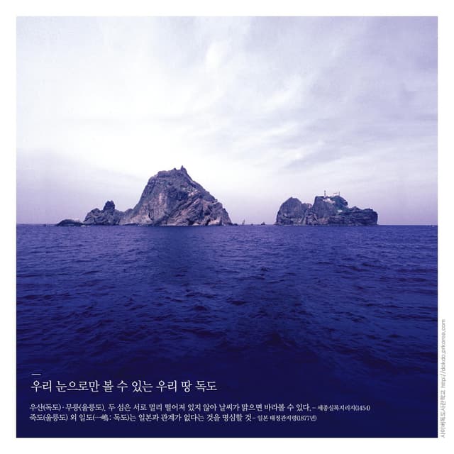
Ulleungdo and Dokdo are sea mountains in the East Sea. Historically, Koreans perceived islands as mountains in water that extend from the land, and used to call them sea mountains. Ulleungdo is a volcanic island that has a unique volcanic landscape with unusual rock formations and steep cliffs, such as the highest peak of Seonginbong (984m). Dokdo, an ancillary island of Ulleungdo, appears to be small, but when the area underwater is included, it actually rises 2,068 meters, which is higher than Hallasan. Four underwater mountains around Dokdo were given the names of historic figures who protected this area. Dokdo was the first victim of Japanese imperialism, and now signifies restored Korean sovereignty.
더 보기 ▾